In order to increase my familiarity with ArcGIS, the Model
Builder program, and various Raster analyses, Professor Cardille recommended
that I complete the Spatial Analyst Tutorial for ArcGIS 10.1. This was especially
beneficial as a refresher for the capabilities of ArcGIS, as I completed GEOG201: Introduction to GIS in Fall 2012. While I recently completed GEOG 308:Remote Sensing this past Fall, we primarily used ENVI 5.0 to analyze the
images, and therefore it has been over a year since I have intensively worked with ArcGIS.
1) Double-check that you are using the compatible version of the Spatial Analyst Tutorial with the version of ArcGIS that you have. While many of the differences between ArcGIS 9.3 and 10.1 and not readily apparent, there are some functions and focuses that differ completely between the two tutorials. So, save yourself a lot of wasted time trying to translate the older version to the modern functions of 10.1.
2) “You will need approximately 90 minutes of focused time to complete the tutorial. Alternatively, you can perform the exercises in sequence one at a time, saving your results along the way when recommended.” The background information about the tutorial suggested
that it would take merely 90 minutes to complete. Having spent much longer completing the tutorial, I can say that this might be overly optimistic for a GIS student.
Perhaps in ideal circumstances, with high powered computers, and ample previous
knowledge/experience with the Spatial Analyst tool bar, a 90 minute completion
time would be true. So, unless you have those qualities, I suggest that you budget a longer period of time to complete the tutorial.

3) It is important to check and understand the errors that can slow down the completion of the tutorial. The tutorial does a great
job about mentioning trouble areas and giving suggestions or hints, however I found that many places online
have forums and blogs about how to fix errors that also arise. For example, if you try to
save a raster file with more than 12 letters or with spaces from ArcGIS, the function will
automatically not work until you shorten the name or remove the space.
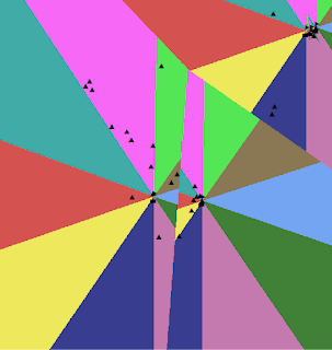
4) It is important to read the steps carefully while completing the tutorial. For example, I accidentally chose Euclidean Direction instead of Euclidean Distance in my model, and this resulted in a skewed output that was not similar to the one pictured in the tutorial. After rereading the tutorial, and the components of my Model, I was able to identify my error.
5) It is helpful to rename data so that you can adequately view it in the weighted overlay tables. While the tutorial has the ‘hint’ that you can put your curser over the area to read the name, this did not occur on my computer.
6)
7) It is important, like with any computer work, that you save your files often, and ArcGIS is not an exception to this. I most likely spent half of the time completing the Spatial Analyst Tutorial with ‘Not responding’, which would prolong the completion of the tutorial. Additionally, if I chose incorrect inputs, sometimes I would be faced with random quits that could have wiped out my data if I hadn't saved the project.
8) Just after working with Model Builder for a few hours, it is clear that it definitely reduces time spent on processing large amounts of data, assuming all of your inputs are correct. I am excited to explore this further.
Of course, it is rewarding to finish the tutorial and have a
suggested location for the new school. This tutorial makes it apparent that
working with ArcGIS or similar suites gets easier with time and
familiarity. I found that I was already more comfortable using the program by the time it took to complete the tutorial itself.


No comments:
Post a Comment